| |
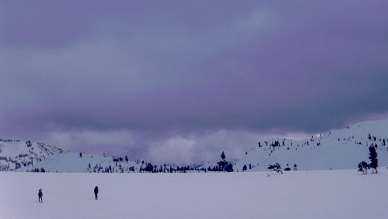
| Lake Aloha on a cold, windy day |
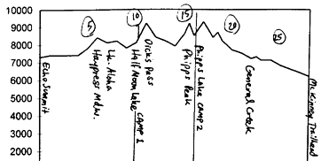
Head north to Echo Lake, then ski westward across Lower and Upper Echo Lakes, and continue northwest to Lake Aloha. Then drop northeast down to Heather and Susie Lakes, and turn northward upcanyon to the general area of Half Moon Lake. Find a site away from avalanche slopes (Camp 1).
Things get interesting first thing the next morning with the ascent and descent of Dicks Pass. For less steepness, stay towards the east on both the approach to and the descent from Dicks Pass. To complete a fine 2-day tour, you could descend north from Dicks Lake, then descend east to Azure Lake (actually, it's best to stay high NE of Azure Lake), and continue to drop towards Cascade Lake, exiting with a steep traverse north of Cascade Lake that takes you to the "Inspiration Point" Emerald Bay overlook.
| |
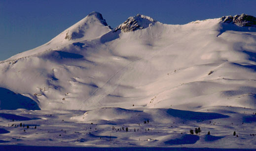
| Early morning light on Pyramid Peak and Lake Aloha; note the slide path diagonal across the face. |
Two miles later, near Richardson Lake (and the Sierra Club Ludlow backcountry hut), General Creek turns eastward. You can ski out to Lake Tahoe via General Creek, but the easier route is to continue north for one more mile to Miller Lake. From there, ski out along the popular McKinney Creek ski route to the McKinney/Rubicon trailhead near Lake Tahoe, about a mile or two south of Homewood.
Some logistical notes: There is no parking at the McKinney Creek trailhead; your best bet is probably to park 2 miles south at Sugar Pine Point State Park ($5/day). Also, there is a SnoPark several miles to the north at Idlewild. All of this area is served by TART's hourly daytime bus service, though TART won't take you all the way to South Tahoe. Highway 89, your best shuttle route between the southern and northern trailheads, is often closed during winter months due to snow, so consider doing this tour in late winter or early spring when that road is open. Average elevation of the tour is almost 8000', so the snow should be fine into March (past mid-March, you will lose snowcover during the tour's final miles, however). The tour should be best south-to-north as described, since that direction has about 1000' less uphill.
An account of our 2/02 trip to the same general area, with photos.