

| |
| Mather Pass (on the right) viewed from Palisade Lakes |
This tour starts with a choice; there are three options for getting from Onion Valley to Rae Lakes:
| |
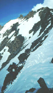
| Marty Cochran (hard to see in the lower left) crests Glen Pass |
From the Raes, follow the John Muir Trail route to Pinchot Pass, taking Camp 2 along the way and Camp 3 around Pinchot. A possible alternative route, instead of the section just south of Pinchot Pass, would be to take White Fork canyon to a pass north of Crater Mtn.
Note: The Moynier guide recommends what looks to be a more interesting (though no more direct) route from Rae Lakes to Mt. Pinchot, via two lateral passes, one just west of Mt. Baxter and the other west of Colosseum Mtn. The first (southern) of these two passes, known as Acrodeetes Col, Grasshopper Pass, or Baxter Col, used to be closed to all public travel year-round, to protect the endangered California bighorn sheep, but that is no longer the case (it remains closed from July through December). Acrodeetes Col (or whatever you want to call it) is rather steep on both sides; Colosseum Col is rather mellow. Overall, this route is a good alternative to the JMT route, if you want to stay at higher elevations, and don't mind another steep pass.
Another route option is Baxter Pass, which is a trail route south of and different from Baxter Col; this can be a handy bail-out point if you have nasty weather and a broken ski like we did a few years ago.
From Pinchot Pass, continue northward roughly along the John Muir Trail route (contour a little towards the east above where you'd join the South Fork Kings to preserve some elevation), across Upper Basin, and over Mather Pass. Then, avoiding the temptation to noodle all the way down to Palisade Lakes, contour at 11300' around to the lakes below Southfork Pass (Camp 4).
Southfork Pass offers two choices; the better of the two pass options is the slightly higher one to the west, 200' of 45 degree snow on each side. On the north side of Southfork, contour northwest over a 12000' notch and descend to Finger Lake. Then proceed north to near Willow Lake and carefully descend the steep trail route well to the east of the creek (if the wet slide hazard is high, another option is to bushwhack along the NW side of the creek below Willow Lake).

| |
| Rock shelter near Glen Pass |